Index
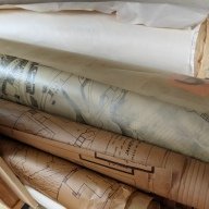
Various plans and maps of Redditch in the 1960's, Studley & outer Redditch 1970, map Watery Lane, Astwood Bank, Studley & Sambourne, Crabbs Cross, Studley, Redditch. Various other maps relating to Town Centre zones Car Parking, Demolitions, proposed ho
gift no condition donation
2 x sets of A-G RDC aerial survey 1965 set of Redditch maps 1960's or before. 2 x OS map Studley & outer Redditch 1970. 2 x OS map Watery Lane.5 x OS maps 1970 Astwood Bank, Studley & Sambourne, Crabbs Cross, Studley, Redditch. 1 x Redditch centre map und
Artefact Collection Details

RDDHM.2022.329 - Plans and maps
Images in this collection are copyright Redditch Local History Museum. Individual items or images in this collection can be made available to members upon request for inclusion in their research. Any images used remain the property of the Redditch Local History Museum and their source should be acknowledged in any published work.
Contact the Museum Archivist for more details archivist@rlhm.online
 Next
View Detail
Prev.


 Next
View Detail
Prev.
